Whangamata 12 hour
Walking down a stream, for hour after hour...........hours after we thought we'd be finished the race.
That's pretty much all I remember of this race, trying to write the blog a few months later.
Wow. Boy, were we in a tough place. Short of food, short on energy, stumbling down a steep gorgy creek with numerous falls, pools, technical difficulties. 2am, 3am, 4am, and we thought we'd be finished around 8pm. Where did this all go wrong?
This race had a Godzone level trek - a full on off track, hours bush bash in impenetrable forest.
We got to this trek stage in good spirits, albeit a number of hours later than the leaders. Bang - we hit the first CP like a brick wall. A tricky off track bush bash from a high point, down and up to hit a ridge and out to another high point. Except we ended up back where we started, doing a complete 360 back along a ridge. Ouch. Loads of teams struggled, and most turned back, opting to finish the bike leg back to the coast.
Not us. No, no, not us. We sat down for a good 40 minutes, looked over our maps, even rang the race director. And decided to go on, because:
A) We had live tracking beacons enabling us to communicate with base - when do you get the chance to test navigation with this level of safety?
B) It was a point to point race, miss a CP and become unranked instantaneously.
C) This IS the next level of nav that we need to work on, we'll never be able to do it, if we don't give it a go.
D) We had an escape route - at any time, if we turned and headed East, we would be funnelled into the river system which would return us to the end of the trek. An excellent (foolproof?) catching feature.
So, we backed ourselves and went for it. Looking over the maps the night before, I was struck with the difficulty of the section between the next two CPs. I couldn't find a handrail, nav feature, catching point - it was just a long stretch through thick bush, relyling on a compass bearing which can so easily go wrong. Talking to other teams the following day, I learned that some experienced navigators actually took a general bearing, put their maps away, and simply said- we have to go that way for a couple of hours, and put away their maps. They planned on the height climb toward the end to put them right - and they had the benefit of daylight, so as they got closer, they could SEE the high point they were aiming for.
Despite pushing hard, and even climbing trees - we didn't manage to spot the high point before the sun went down. In the dark, we knew our chances were slim, so turned to Plan B, and headed out through the river.
Hours later, stressed, tired, over it, we had to face reality. It was taking SO long to get down the river to the next CP, something must be wrong. The only alternative I could see, was that we had headed south PAST the previous CP, and instead of being in the river which would track us north back to transition, we were in the river which would keep going West and take us to Thames. It's a long walk back from Thames. We dug out the yellow tracker. "Please confirm position". And we trudged on.
About 40 mins later a reply came, confirming that Plan B was in fact successful, it was just very slow, and we were tracking as planned towards the next CP.
Wow. Boy, were we in a tough place. Short of food, short on energy,
stumbling down a steep gorgy creek with numerous falls, pools, technical
difficulties. 2am, 3am, 4am, and we thought we'd be finished around
8pm. Where did this all go wrong?
Learning:
We've discussed this so much. The following day, the following week, months later. We still back the decision to go for it, even though it resulted in hours of torment. We're proud we had the guts to give it a go. You don't learn to swim without getting in the water............
Altimeter - I need a good accurate one as we could have used it to help us know when we were off the table lands to a sufficient height.
Get all the way to a high point before taking a bearing - being just 50 m off top will run the risk of heading back up to the same high point!
Even when you've given up and decided just to go home, keep eating, drinking, talking, planning, as it might be HOURS until you make it home. We stopped eating, drinking, and lost the will to live, and this made our exit even longer and slower.
If you get an emergency evac in a vehicle at 4am, you'll struggle to find the driveway into the forest where you hid your bikes.
And, you know you've had a long day, when your alarm to get up that morning for the race, goes off just as you get into bed after the race..............

Saturday, 11 November 2017
Friday, 13 October 2017
Marokopa Munter
Marokopa Munter Munted Me.
A 24 hour is a big undertaking - finding a crew at late notice is difficult. So, race day brings a whole new dawn of teammates. This totally awesome group of women, have signed up to be the only women's team in a tough 24 hour event, and they are pretty much novices to AR. Lauren has done ONE 12 hour event. Lyndy and Tracey have done a handful of 6 hours. That said, I've done my research, these ladies have a pedigree of long distance events, in triathlon and running; and word on the street is that they have the most important X factor. Attitude. I've basically convinced them, assured them, sales pitched them to get them to agree to do this. As a result, I'm taking the start line feeling very nervous and very responsible. Responsible for their enjoyment. Responsible for their safety. Responsible for the navigation. Whew!!


The race starts with a bang and a fast foot race through the (3) streets of Marokopa to the beach. In true form to being the only women's team, I run all of 300 metres and am rapt to be able to stop at the public toilets. As a result we are back packers when we hit the thigh deep river crossing which is WAY deeper than our thighs. Also, my sealy bags of snacks aren't sealed properly so I now have manky salty frooze balls and scroggin. Blearrchh!
 We are stunned by the views as we climb high above the wild west coast. Climbing is a theme for the day, but at least there are views!! I'm way too conservative in the nav on this leg, so desperate to not get the team wrong early. I can see the intended route would be to follow the ridge and pop out at the farmland, but I'm really nervous about not hitting the correct ridgeline, and I know from experience how easy it is to be drawn sideways off a ridge when heading downhill. So we opt for the safe option around the outside which has way too much climbing. Worse news, apparently the middle route had a fire break that teams just jogged down that wasn't mapped. Good news (well, not for them) a couple of teams that were well ahead of us, still haven't arrived at the farm, showing that the nav mistakes I was afraid of were a distinct threat!

 We manage to totally goof off when we see the photographer pulling off our only run of the day.....
The remainder of the trek is on farmland. Bloody hard to navigate on farmland, the only handrail features are fences, half of them are wrong and they other half aren't on the map. Lyndy is obsessed with bees and wants to go past all of the hives, and trying to constantly go around all the fields of dangerous looking Bulls is trying my patience and nav skills. After skirting 3-4 paddocks, we come to a gate with a big looking bull within 20 m of the gate, glaring at us. The ladies say no, and I'm ashamed to say that I just opened the gate for them and made them walk through the paddock with the bull. After reassuring them the night before, that they could tell me any time they felt unsafe, I basically herded them into the paddock, no doubt with a grouchy look on my face. I did walk closest to the bull on my left, while they all scurried through on my right. This is probably the worst captaincy I've ever shown, sorry ladies!
We move solidly through the rest of the trek, and our nav keeps us up with a couple of other teams who are moving faster, but sometimes in the wrong direction. It's always a good feeling! We have a hairy river crossing which we underestimated slightly, and are pleased to be hopping on to our mountain bikes while the kayakers will paddle the same route in the river which the road is following.
Totally gutted to get to the next CP, clearly marked on a bridge, to find that the bridge is broken and the CP is on the far side. Obviously no problem for the kayakers, but nearly a 10km round trip for the MTBers to go back for it. I'm totally not biking back! No way! I'll swim. And then Lauren, who is a competitive surf life saver feels obliged to offer to swim as obviously the strongest swimmer amongst us. I really wasn't hinting Lauren, but gosh you swim well!
We hit the transition after the long trek and short MTB, right on dark. That's a long day so far and a lot still to be done. Back on the bikes and there is a clear route choice to head around the beach and cut off a BIG, LONG UPHILL bike ride to Kiritehere Beach. We decide to give it a punt. I can confirm there is nothing quite as scary as trying to walk through thigh deep water, on a rocky reef, carrying a bike, while wearing bike shoes, IN THE DARK. We made it around the first point and chose to skirt up through the farm for the next. Overall, we caught up with other teams so it was a good option, but it felt pretty dodgy.

The big boring bike ride up kilometres of gravel road took a big toll out of us. Tracey had been fighting a bad virus all week, and was really digging deep here. I was working hard to stay close on the map and rapt to be hitting all the CPs spot on, even when other teams were riding back down the hill looking for those they had missed.
 Transition in the dark and walk off into the unknown. This night leg had a tricky off track bush bash - I got tight on a bearing and took my team up hill and down dale, scrambling down banks and into creeks - my favourite way to move through the bush. Basically I got this completely wrong and emerged way west of the track marked on the map, just luckily the track extended further than drawn and we found a faint trail which we followed to the CP. Relief!!
3am. I'm tired and cold. It's drizzling, hails on us for a while, and I realise that I'm paying for my lightweight gear choices. I don't want to stop and have to strip and stand in the cold to add extra layers, so I push on but I'm starting to get a bit incoherent. Tracey, bless her, is feeling so unwell, when I stop to navigate she just sinks into a weary crouch and stays there motionless until we start moving again. However, in her own pain she is still able to recognise mine and eventually makes us stop and while I strip and wait, they each hold a layer ready for me to get back into as quickly as possible. Nothing like having your newbie team take care of you to humble you back into a good place!
We've kept up with a few teams here, and for a while all of us are milling around and going back and forward unsure of the next step. It's late, dark, wet again, we're cold, and I contemplate pitching the tent and waiting for dawn. Is that what the team needs now? Morale is pretty low. Lyndy is still thinking clearly and suggests we walk up the hill again to look for the airstrip as an attack feature, she sells the idea in that walking up the hill at least we will stay warm! She's totally right, and once we get there, it quickly falls into place and we head off quickly in the right direction.
8am Sunday morning, we wander into transition to be met with hot pies and milos. Mate, we could have kissed that bloke who kept the food hot for us even after allotted time. Best food I've ever eaten, and a good representation of the hospitality of the event, where even the prizegiving came with a delicious meal just right for sensitive stomachs after 24 hours of abuse. We get a truck drive home, out of time to do the bike ride to transition or final rogaine. Technically this is a DNF, but it really doesn't feel like a failure.

This crew. Wow. Ladies, that was tough. Really tough. So tough, there were long periods where I really wasn't enjoying it. But you had awesome attitudes, dug deep, and I'm super proud that we were brave enough to put ourselves out there. Thanks so much for answering my calls!
It's hard to sum up a race in a ten minute read. 24 hours of sometimes repetitive nastiness. Sometimes boring, sometimes scary. Sometimes exhilarating, sometimes hilarious. I'm not sure I can express how our bodies were feeling, or how taxing it was trying to positively lead when I felt so responsible. This was not fun. Mostly. But we managed to have some really fun times, and some awesome adventure. Those are the bits I'll remember.
Learning:
Appreciate the bravery of people prepared to take on a 24 hour race.
Back myself navigationally - take the shorter option, just take it carefully.
More straight line deep bush compass work required - still not sure how I got the night bush bash wrong, still relieved it turned out ok!
Captaincy - this was probably both my best and worst race. I'm not sure now what I'd do in hindsight about the bull. Did I need to explain better how hard it was for me to continually navigate around them? Follow through on my word that I wouldn't let anyone feel unsafe. Reassure them? Dunno. I'll keep thinking on this.
River crossings - always link up, even if it looks easy.
A 24 hour is a big undertaking - finding a crew at late notice is difficult. So, race day brings a whole new dawn of teammates. This totally awesome group of women, have signed up to be the only women's team in a tough 24 hour event, and they are pretty much novices to AR. Lauren has done ONE 12 hour event. Lyndy and Tracey have done a handful of 6 hours. That said, I've done my research, these ladies have a pedigree of long distance events, in triathlon and running; and word on the street is that they have the most important X factor. Attitude. I've basically convinced them, assured them, sales pitched them to get them to agree to do this. As a result, I'm taking the start line feeling very nervous and very responsible. Responsible for their enjoyment. Responsible for their safety. Responsible for the navigation. Whew!!


Anyway - we look good!
 |
| Lyndy proving very capable helping with the route planning |

The race starts with a bang and a fast foot race through the (3) streets of Marokopa to the beach. In true form to being the only women's team, I run all of 300 metres and am rapt to be able to stop at the public toilets. As a result we are back packers when we hit the thigh deep river crossing which is WAY deeper than our thighs. Also, my sealy bags of snacks aren't sealed properly so I now have manky salty frooze balls and scroggin. Blearrchh!


Mystery Activity - Shooting. Nailed it. One of the best scores. Woop woop.
As we run down the road we contemplate that we've been racing for 5 hours, and we are now comfortable enough to squat in a little row and wee right beside each other. No point delaying the inevitable, there is going to be no room for any preciousness.

The remainder of the trek is on farmland. Bloody hard to navigate on farmland, the only handrail features are fences, half of them are wrong and they other half aren't on the map. Lyndy is obsessed with bees and wants to go past all of the hives, and trying to constantly go around all the fields of dangerous looking Bulls is trying my patience and nav skills. After skirting 3-4 paddocks, we come to a gate with a big looking bull within 20 m of the gate, glaring at us. The ladies say no, and I'm ashamed to say that I just opened the gate for them and made them walk through the paddock with the bull. After reassuring them the night before, that they could tell me any time they felt unsafe, I basically herded them into the paddock, no doubt with a grouchy look on my face. I did walk closest to the bull on my left, while they all scurried through on my right. This is probably the worst captaincy I've ever shown, sorry ladies!
We move solidly through the rest of the trek, and our nav keeps us up with a couple of other teams who are moving faster, but sometimes in the wrong direction. It's always a good feeling! We have a hairy river crossing which we underestimated slightly, and are pleased to be hopping on to our mountain bikes while the kayakers will paddle the same route in the river which the road is following.
Totally gutted to get to the next CP, clearly marked on a bridge, to find that the bridge is broken and the CP is on the far side. Obviously no problem for the kayakers, but nearly a 10km round trip for the MTBers to go back for it. I'm totally not biking back! No way! I'll swim. And then Lauren, who is a competitive surf life saver feels obliged to offer to swim as obviously the strongest swimmer amongst us. I really wasn't hinting Lauren, but gosh you swim well!
We hit the transition after the long trek and short MTB, right on dark. That's a long day so far and a lot still to be done. Back on the bikes and there is a clear route choice to head around the beach and cut off a BIG, LONG UPHILL bike ride to Kiritehere Beach. We decide to give it a punt. I can confirm there is nothing quite as scary as trying to walk through thigh deep water, on a rocky reef, carrying a bike, while wearing bike shoes, IN THE DARK. We made it around the first point and chose to skirt up through the farm for the next. Overall, we caught up with other teams so it was a good option, but it felt pretty dodgy.

 |
| A shot of the reefs we were trying to walk over in the dark at nearly high tide - with bikes! |
The big boring bike ride up kilometres of gravel road took a big toll out of us. Tracey had been fighting a bad virus all week, and was really digging deep here. I was working hard to stay close on the map and rapt to be hitting all the CPs spot on, even when other teams were riding back down the hill looking for those they had missed.

3am. I'm tired and cold. It's drizzling, hails on us for a while, and I realise that I'm paying for my lightweight gear choices. I don't want to stop and have to strip and stand in the cold to add extra layers, so I push on but I'm starting to get a bit incoherent. Tracey, bless her, is feeling so unwell, when I stop to navigate she just sinks into a weary crouch and stays there motionless until we start moving again. However, in her own pain she is still able to recognise mine and eventually makes us stop and while I strip and wait, they each hold a layer ready for me to get back into as quickly as possible. Nothing like having your newbie team take care of you to humble you back into a good place!
We've kept up with a few teams here, and for a while all of us are milling around and going back and forward unsure of the next step. It's late, dark, wet again, we're cold, and I contemplate pitching the tent and waiting for dawn. Is that what the team needs now? Morale is pretty low. Lyndy is still thinking clearly and suggests we walk up the hill again to look for the airstrip as an attack feature, she sells the idea in that walking up the hill at least we will stay warm! She's totally right, and once we get there, it quickly falls into place and we head off quickly in the right direction.
8am Sunday morning, we wander into transition to be met with hot pies and milos. Mate, we could have kissed that bloke who kept the food hot for us even after allotted time. Best food I've ever eaten, and a good representation of the hospitality of the event, where even the prizegiving came with a delicious meal just right for sensitive stomachs after 24 hours of abuse. We get a truck drive home, out of time to do the bike ride to transition or final rogaine. Technically this is a DNF, but it really doesn't feel like a failure.

This crew. Wow. Ladies, that was tough. Really tough. So tough, there were long periods where I really wasn't enjoying it. But you had awesome attitudes, dug deep, and I'm super proud that we were brave enough to put ourselves out there. Thanks so much for answering my calls!
It's hard to sum up a race in a ten minute read. 24 hours of sometimes repetitive nastiness. Sometimes boring, sometimes scary. Sometimes exhilarating, sometimes hilarious. I'm not sure I can express how our bodies were feeling, or how taxing it was trying to positively lead when I felt so responsible. This was not fun. Mostly. But we managed to have some really fun times, and some awesome adventure. Those are the bits I'll remember.
Learning:
Appreciate the bravery of people prepared to take on a 24 hour race.
Back myself navigationally - take the shorter option, just take it carefully.
More straight line deep bush compass work required - still not sure how I got the night bush bash wrong, still relieved it turned out ok!
Captaincy - this was probably both my best and worst race. I'm not sure now what I'd do in hindsight about the bull. Did I need to explain better how hard it was for me to continually navigate around them? Follow through on my word that I wouldn't let anyone feel unsafe. Reassure them? Dunno. I'll keep thinking on this.
River crossings - always link up, even if it looks easy.
Friday, 22 September 2017
Tarawera Trail and Exploring
NZ Topo Maps is a dangerous thing. A little browsing..... I wonder what that is? You must only be able to get there by boat? Or could I get there cross country.......?

 So, while all the 'normal' people from the Papamoa Running Buddies group ran the Tarawera Trail to Hot Water Beach, took a boat trip back to the start point and relaxed in a cafe........ when we got to half way, I got out map, compass, gaiters and arm warmers, and headed off to explore.

My plan was, to stay high until I had the distance, and then find my way down into the river valley. Contours looked ok. I wasn't expecting any difficulties. (Famous last words)
Anyway, it turns out that those contour lines aren't gradual 20m drops, the terrain is littered with straight down 20m banks into crevasses and I keep getting stuck.

A - multiple forays to the edge of the river gorge before skirting around
B - hit another stream gorge that I wasn't expecting, follow it until I find a lower part I'm happy to scramble down into where I can see that the other side will be ok to climb out of
C - hit another stream gorge, try north, and find a way in. Not sure if I can get out again, but by now I'm frustrated and impatient so I give it a crack.


My little gorge gets narrower and narrower until..............


I end up crawling through little holes!
But finally I make it to the river valley, the valley of the wallabies as it turns out - I have never seen SO many wallabies!!

I end up on a beautiful valley path, all the way to a punga fence with open gateway. I wander in - the buildings are set up like a little camp - a few cabins, one that looks like a lounge space. It's all very quiet, but there is washing out at one cabin. I'm a bit shy and walk straight through, not sure if I'll be welcome or not.

After cooling my feet in the lake, I turn around to retrace my steps....... and walk straight into a big NO TRESPASSERS sign. I guess they don't bother to sign the bush entrance, probably no one has ever come through there before. As a result, I nervously bush bash around the camp, now worried about irate landowners and vicious dogs.


Thursday, 31 August 2017
Clare's 50km ultra training
I hate to run. Yes I've said it before. But, I love to plan routes, to navigate, to be a tour guide. So I piggybacked Clare's run training for Tarawera 50km. She gave me the brief, distance, technicality, climb and I designed the courses. Of course I had to run them with her, and quadrupled my run distance with no warning! Bloody pleased the body help up, although towards the end of these runs, she was still sprightly and I was struggling.


Saturday, 5 August 2017
Whangamata 12 hour
Even though ARC in February wasn't Jen's favourite introduction to the new sport of AR, I somehow convinced her to give it a shot at Whangamata. Christine was our support crew at ARC; a friend from orienteering, I'm in awe of her nav and have managed to swing her along to this one also. Christine expressed some concern over 12 hours vs 6, but I've assured her we will be fine.............

Boom, we are off. Fairly hectic start, lots of bikes moving fast, a couple of crashes. Someone breaks a chain and the 30 seconds that it takes me to find a chain link and throw it to them, sees our team near the back of the bottleneck heading into the narrow, clay single track. We've discussed this the evening before. It's so dodgy to miss checkpoints early, and run the risk of finishing early and allowing teams behind you to continue collecting points and finish ahead even if moving more slowly. But, Jen and I were burned taking our bikes into a mud pit at ARC, and we really don't want it to happen again. So, we head straight up the road and miss the nasty push bike grind. A decision I'll stand behind! It was also fun to be in the very front, and have the speedy teams come back past us 20 minutes or so later!

Stage 2 trek was fast, tricky and fun. It was great working alongside Christine, hearing her take on the map, and having a solid navigator alongside. Christine was finding the maps a struggle as they are so indistinct and lacking in detail compared to orienteering maps, but she was better than me at using the topography and ignoring everything else. We got CPs on high points, trees, tunnels!
Heading up towards the far end of the loop, Tom's (much faster) team came racing down. Owen was having chafing issues and Tom had told him that if they could find me, I was bound to have some anti-chafe with me. He looked super relieved, as I fished it out of an easily accessible pocket of my Sport Billy bag.


Starting the final MTB in the dark wasn't what we were expecting. We only had about an hour, and had to choose between going West for two checkpoints and finishing early, or going East for three checkpoints and having to push hard back up a hill. Of course we went East, but on getting to the bottom of the hill we found we were too fatigued to push out bikes up narrow tricky trails, so we just rode back up the big hill again and went East. Better value for money though!


It's so much less stressful when you're not the most experienced navigator.
Always consider how long a leg will take and if it's worth it - do you take the gamble and miss it out?
Thursday, 13 July 2017
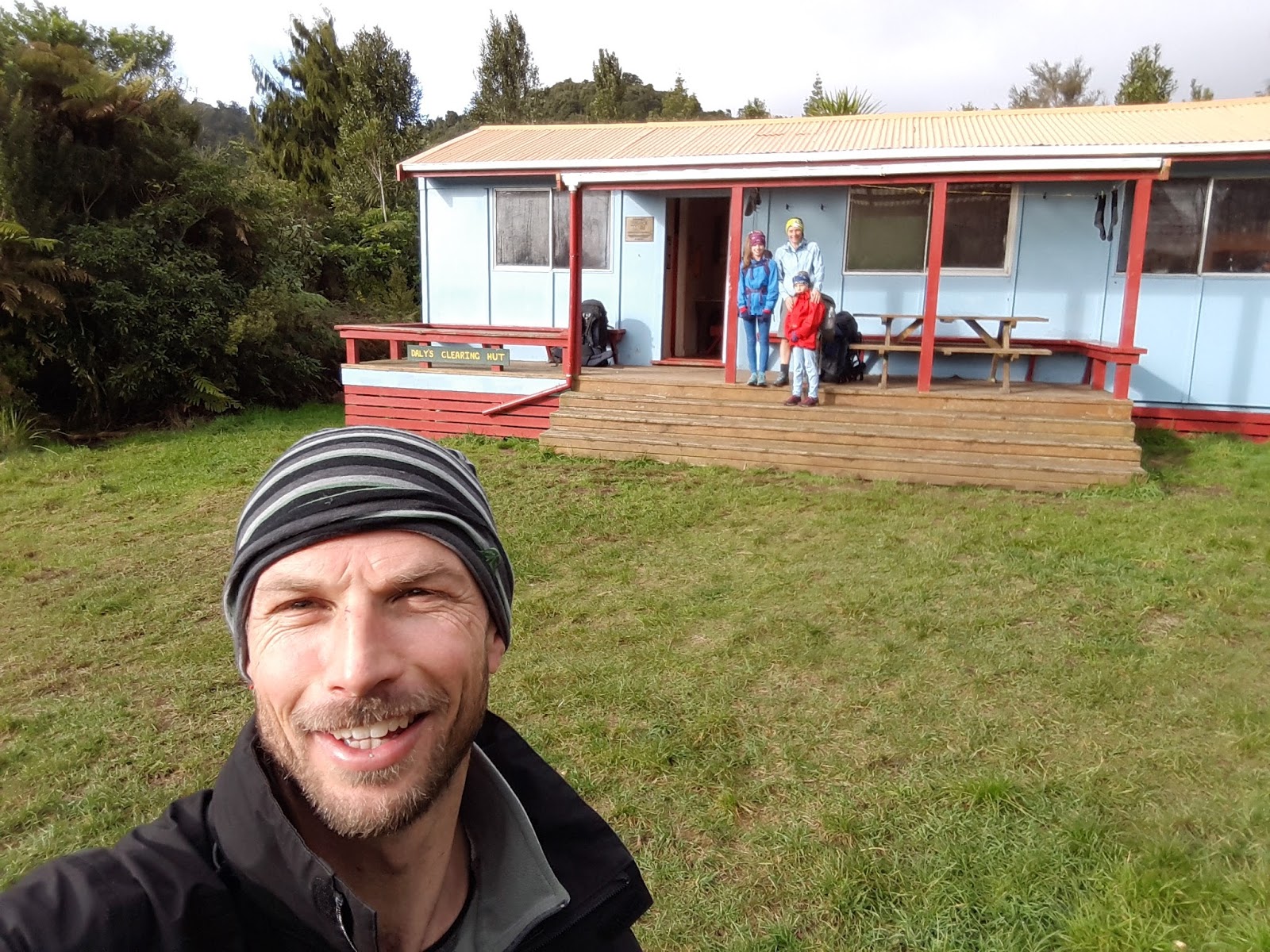
Daly's hut - no fire!!!

Entering the bush after the poopy farmland access.


We wanted to try out the kids brand new Macpac sleeping bags. After much discussion about the expense, the practicalities, the safety aspects, current financial constraints...... we couldn't look past the fact that both Tom and I have top notch Macpac sleeping bags and have never been cold. Safety and comfort won out, we bit the bullet and purchased Macpac Latitude 500s.
On arriving at the hut to find it didn't have a fire, on a night when it snowed in Rotorua, we felt totally justified!!


And, our last tramp in sneakers. A number of hours of boggy trail, and looking at the extra energy used in trying to hop over and around bogs, we will be moving to waterproof boots for future tramps. Jess is also often rolling an ankle, so we'll try a bit of ankle support for her.
2:15 in from Franklin Road over the hill, 5.5 km. 1:45 out along the river, 4.5km.
Kids thoughts:
Kate (12)
I really enjoyed dailys hut, one thing I noticed is it was really slippery on the way back, also the toilet was very far away from the hut.
Jess (9)
Tuesday, 13 June 2017
Waihi Training Mission
Good times with Clare!!!
Cycle Hauraki Rail Trail - Waihi to Kauaeranga. Nice, sociable, warm up.
Run - Mt Karangahake and get no views due to the grey clouds.
Run - back to bikes and look at Mt Karangahake against a blue sky backdrop!
Ride back to car.
Must do this again some time!


Cycle Hauraki Rail Trail - Waihi to Kauaeranga. Nice, sociable, warm up.
Run - Mt Karangahake and get no views due to the grey clouds.
Run - back to bikes and look at Mt Karangahake against a blue sky backdrop!
Ride back to car.
Must do this again some time!


Subscribe to:
Posts (Atom)